

Description
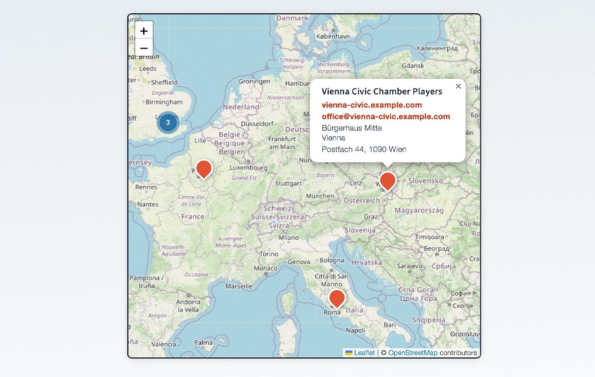
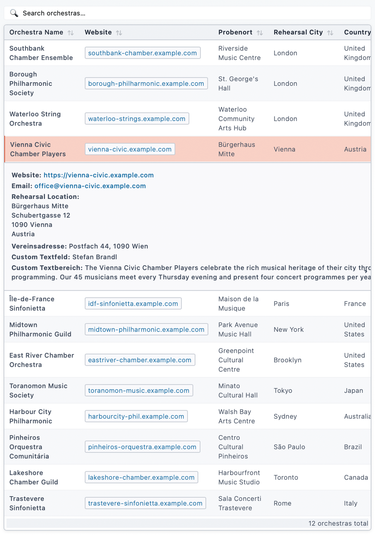
Orchestra Map lets you build an interactive directory of orchestras (or any kind of location-based entries) and display them on a Leaflet map, in a filterable list, or with a standalone search bar.
Core features (free)
- Interactive map via [orchestra_map] shortcode – powered by Leaflet.js and MarkerCluster
- List view via [orchestra_list] shortcode – filterable, connected to the map
- Search bar via [orchestra_search] shortcode – communicates with map and list via DOM events
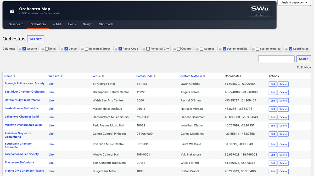
- Add / edit / delete orchestras in a clean admin UI
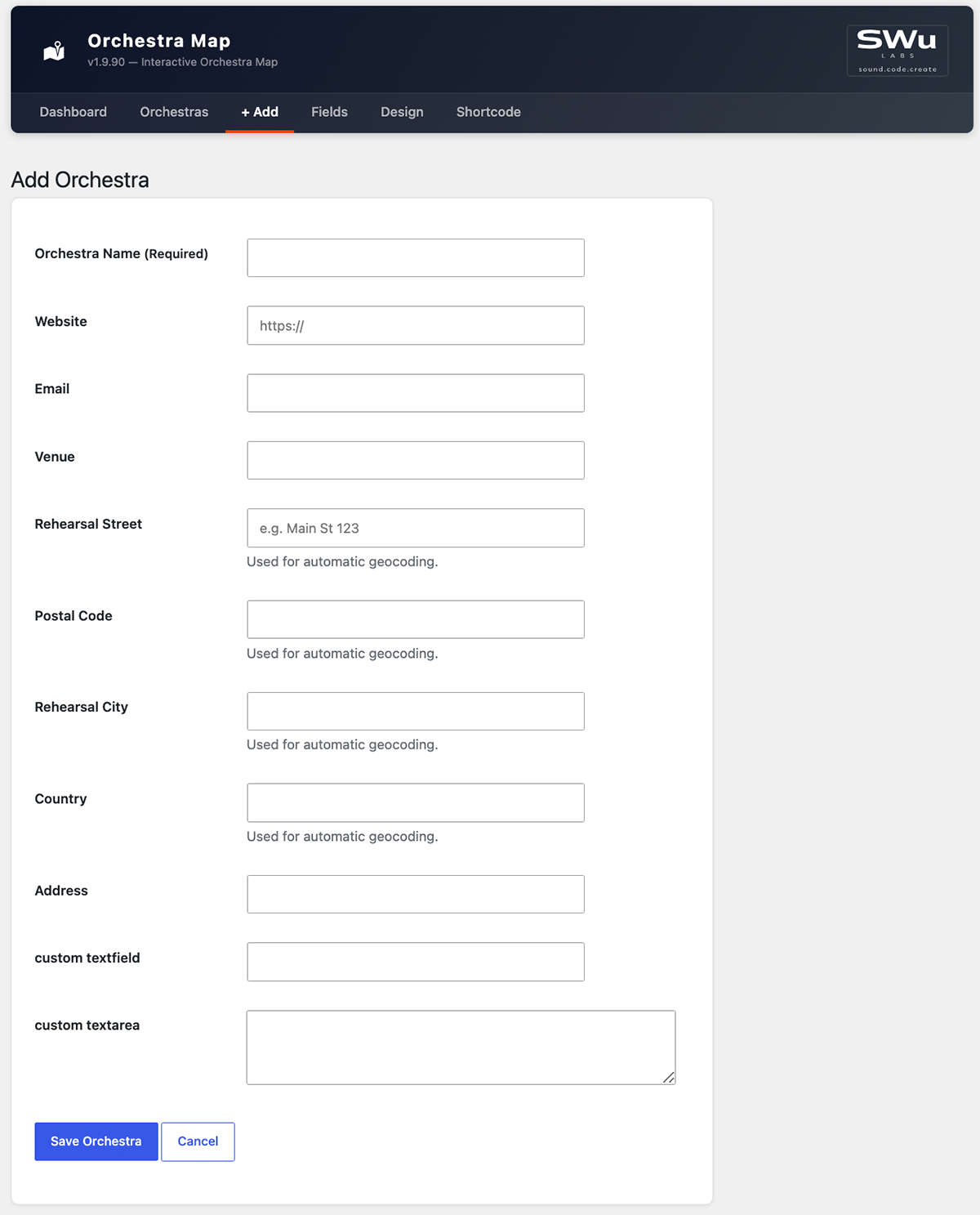
- Built-in fields: Name, Website, Email, Venue name, Address, ZIP, City, Country
- Custom Fields – add, reorder, and label your own data columns in the Fields settings page
- Design settings – customise map colors, fonts and sizes in the Design settings page
- Geocoding – converts addresses to coordinates automatically via OpenStreetMap Nominatim (free, no API key required)
- Shortcode reference – full attribute documentation for all shortcodes, right in the admin
Pro add-on
The Orchestra Map Pro add-on (sold separately at swulabs.com) extends the free plugin with:
- Import & Export (CSV / Excel)
Shortcode reference
Site-wide defaults (colors, initial map view, which fields show where) are configured on the Design and Fields admin pages. The attributes below only override those defaults for a single shortcode instance – see the in-plugin « Shortcode » admin page for the full reference.
[orchestra_map]
Attribute
Default
Description
height
600px
Map height (any CSS value)
lat
51.1657
Initial map center latitude
lng
10.4515
Initial map center longitude
zoom
6
Initial zoom level
address
(none)
Initial map center as an address, auto-geocoded and cached (overrides lat/lng)
radius_km
(none)
Fit the initial view to this radius in kilometers (overrides zoom)
search
yes
Show integrated search (yes/no)
search_position
top
Search position (top/bottom)
[orchestra_list] – displays a filterable table of all geocoded orchestras.
[orchestra_search] – standalone search input; communicates with the map and list via the custom DOM events om:filter and om:select.
Credits
This plugin bundles the following open-source libraries:
- Leaflet – BSD-2-Clause License, Copyright (c) 2010–2023 Vladimir Agafonkin
- Leaflet.markercluster – MIT License, Copyright (c) 2012 David Leaver
- Geocoding via OpenStreetMap Nominatim – usage subject to the Nominatim Usage Policy
- Map tiles via OpenStreetMap – © OpenStreetMap contributors, data licensed under the Open Database License (ODbL), tile usage subject to the Tile Usage Policy
Captures d’écran
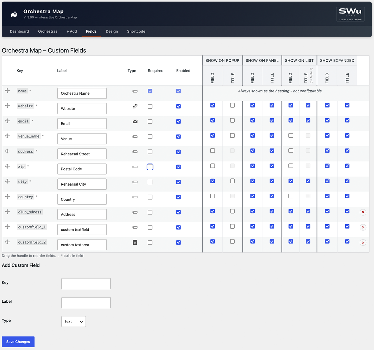
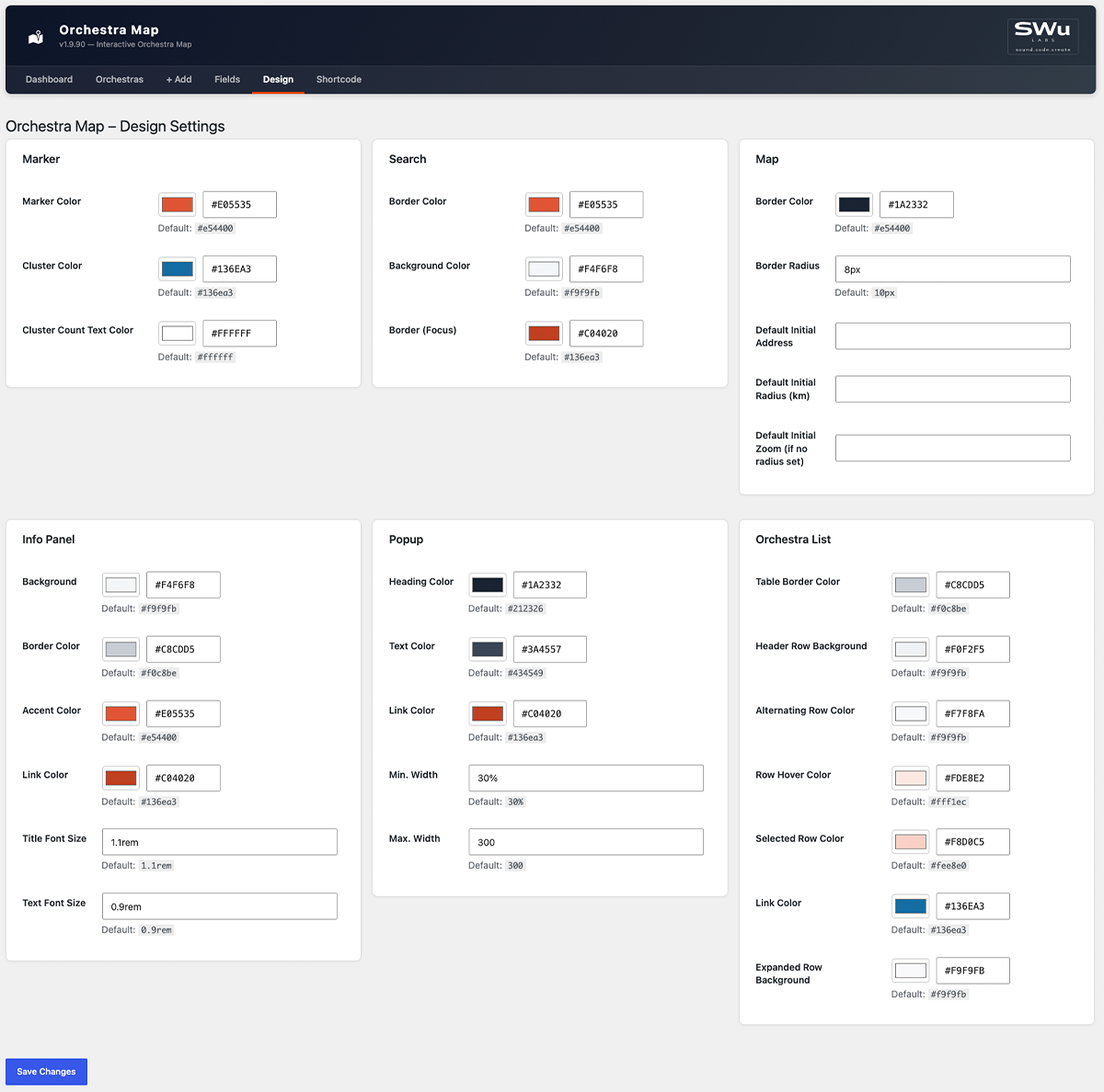
Installation
- Upload the
orchestra-mapfolder to/wp-content/plugins/. - Activate the plugin via Plugins Installed Plugins.
- Go to Orchestra Map + Add and create your first entry.
- Use the geocoding button in the orchestra list to convert addresses to coordinates.
- Insert
[orchestra_map]into any page or block.
FAQ
-
Does this plugin require an API key?
-
No. Geocoding uses OpenStreetMap Nominatim, which is free and requires no registration.
-
Does this plugin send data to external servers?
-
Two kinds. Geocoding sends the address fields (street, ZIP, city, country) of an orchestra entry to the OpenStreetMap Nominatim API (nominatim.openstreetmap.org) to retrieve geographic coordinates — always initiated by an admin action, never automatically in the background. Subject to the Nominatim Usage Policy.
Separately, every visitor viewing the [orchestra_map] shortcode loads map tiles directly from the OpenStreetMap tile server (tile.openstreetmap.org) in their own browser — no orchestra data is sent, only standard map tile requests. Subject to the Tile Usage Policy. High-traffic sites should consider a commercial tile provider per that policy.
-
How many orchestras can I add?
-
There is no hard limit. The plugin stores data in a custom database table.
-
Can I import from Excel or CSV?
-
Import and Export are available in the Orchestra Map Pro add-on.
-
Can I customise the map colors and fonts?
-
Yes. The free Design settings page lets you customise marker, search, map, info panel, popup and list colors and sizes.
-
Can I add custom data fields?
-
Yes. The free Fields settings page lets you add, reorder and label your own custom data fields.
-
Is the plugin compatible with Full-Site Editing (FSE) themes?
-
Yes. The shortcodes work in both classic and block-based themes.
Avis
Il n’y a aucun avis sur cette extension.
Contributeurs & développeurs
« Orchestra Map » est un logiciel libre. Les personnes suivantes ont contribué à cette extension.
Contributeurs
Traduisez « Orchestra Map » dans votre langue.
Le développement vous intéresse ?
Parcourir le code, consulter le SVN dépôt, ou s’inscrire au journal de développement par RSS.
Historique des changements
1.9.90
- Fix: One constant (
GEOCODING_FIELD_KEYS) didn’t carry the plugin’s naming prefix, per WP.org review feedback – renamed toORCHESTRA_MAP_GEOCODING_FIELD_KEYS. - Change: All internal CSS classes, IDs, CSS custom properties and custom DOM events switched from the
om-prefix toorchestra-map-(e.g.om-cardorchestra-map-card, eventom:filterorchestra-map:filter), to avoid the short, generic prefix colliding with other plugins/themes on the same page.
1.9.89
- Fix: Saving the Fields settings page while a venue-group field’s « Field » checkbox was off (making its shared « Title » checkbox disabled) silently reset that Title flag to off, discarding the previously saved value instead of preserving it.
- Fix: Adding a custom field with a key that already existed silently added nothing while still showing « Field settings saved. » – now shows a clear « already exists » error instead.
- Fix: A pasted non-breaking space, zero-width space, or byte-order-mark in a Label field could pass as « non-empty » while rendering blank; detecting a blank label now strips these too, not just plain ASCII whitespace.
- Change: The default Cluster Color is now a shade of blue matching the plugin’s usual accent color, instead of Leaflet’s default green, so it’s consistent with the rest of the built-in color palette.
- Feature: The Design settings page’s Marker section now has a « Cluster Count Text Color » field, for the number shown inside each cluster bubble – defaults to white, since it wasn’t previously configurable and the darker default cluster background made the old (unstyled) text hard to read.
1.9.88
- Fix: The Orchestra List’s « Alternating Row Color » (zebra striping) never actually showed – each row’s hidden expanded-row sibling in the page threw off the even/odd counting the striping relied on, so it only ever matched hidden rows. Rows are now striped explicitly instead of relying on position, so this works correctly.
1.9.87
- Feature: The Orchestra List’s own link color and its expanded (accordion) row background are now independently configurable on the Design settings page (« Link Color », « Expanded Row Background » under Orchestra List), instead of silently reusing the Info Panel’s colors. Changing the Info Panel’s background/link color on the Design page no longer affects the list view at all.
1.9.86
- Fix: The new cluster color (1.9.84) made the cluster bubbles fully solid, losing the lighter-ring-around-a-darker-circle « halo » the default green/yellow/orange clusters had – restored with the custom color, so clusters still visually read as « grouped » at a glance.
1.9.85
- Fix: Clearing a color or dimension field on the Design settings page (e.g. Border Radius) and saving crashed with a hard error page instead of a normal validation message. Clearing a field now resets it to its default instead.
- Feature: Every field on the Design settings page now shows its default value underneath, so it’s clear what a field resets to (or started as).
For older versions see changelog.txt.